

Forest fires pose a real danger inFrance and around the world, with serious consequences for people and the natural environment, particularly during the summer months. To address this and take into account the impacts of global warming, here is the online forest fire risk forecast. Take a closer look at this tool for assessing the risk of fire outbreaks, complemented by interactive maps showing fires here and elsewhere.

Forest fires in France
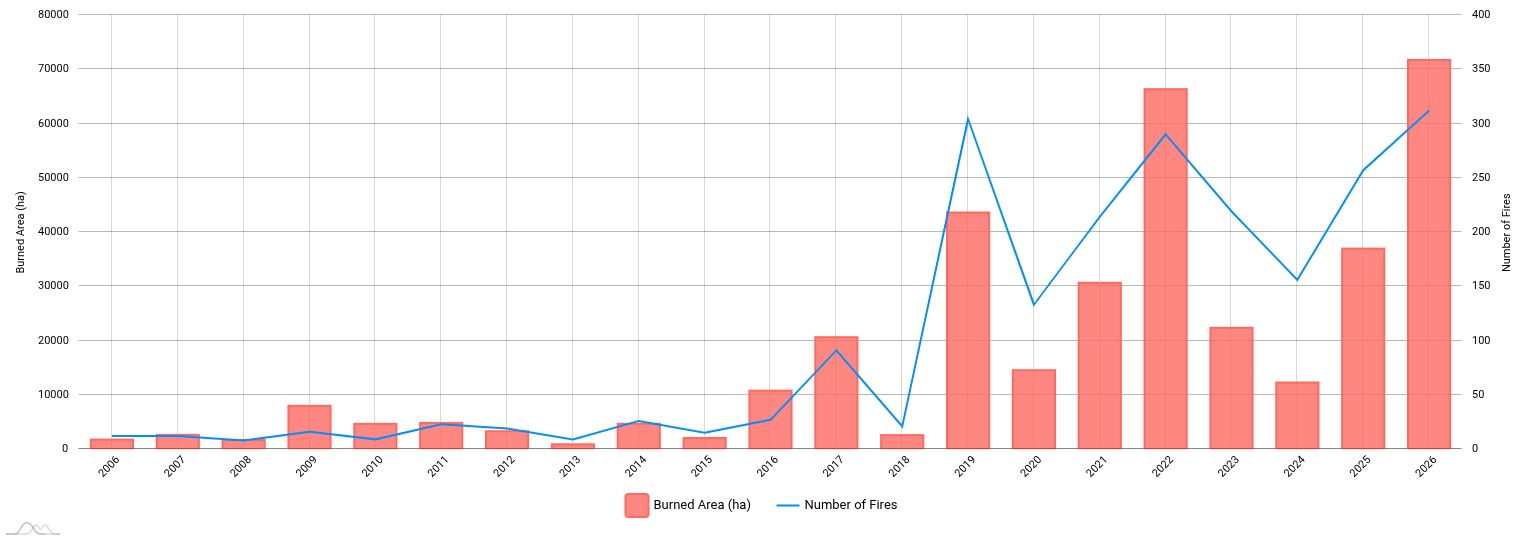
The increase in the number of fires in France and the number of hectares burnt has been a constant trend for over 10 years.
Two figures to back up this observation. The number of fires from 206 to July 2006 (blue line) and the number of hectares burnt during the same period (red bars):
What is forest weather?
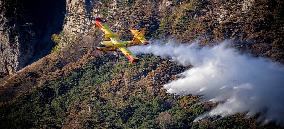
As a result of climate change, wildfires are becoming more severe both globally and in France, prompting the introduction of further preventive measures.
From last June until September, Météo France is providing information on forest weather conditions and the associated fire risks.
This daily map-based information is a key factor in assessing the risk of fire in regions across France. It takes into account various parameters such as rainfall, temperature, air humidity, wind speed and the dryness of vegetation.
For example, the weather conditions that contribute to forest fires are as follows:
- A temperature above 25°
- Strong winds, from 20 km/h
- Low humidity, with a relative humidity of less than 30 per cent
- Dry vegetation that catches fire easily (scrub, etc.)
Forest weather on video
Understand how it works in 1 minute:
Forest fire danger levels
The fire risk is categorised into several levels of danger, ranging from green (low) to red (high), based on the data collected and the observed drought conditions.
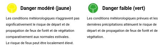
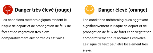
Based on this classification, a map is produced every day. Like weather forecasts, it covers the whole of France and is broken down by department.
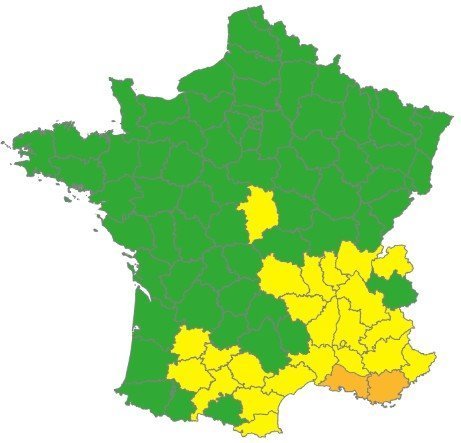
Where there is a high risk, it is important to be extra vigilant, to refrain from lighting any fires – including smoking – and even to avoid going into the forest when conditions are particularly unfavourable.
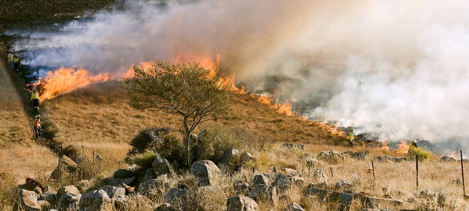
Fire prevention
Beyond these forest fire forecasts, it is day-to-day prevention and the constant taking of precautions that everyone must practise, all year round.
Preventing fires
If you’re planning a trip to the forest, here are some practical tips to help prevent the risk of fire:
- Find out about the danger levels
- Please follow the instructions issued by the local authorities and observe the signs in place
- Avoid lighting fires near forests and areas of scrub or dry grass
- Please do not throw cigarette ends on the ground and use ashtrays when outdoors
- Take care when using tools or vehicles that may produce sparks, particularly near dry or sensitive areas.
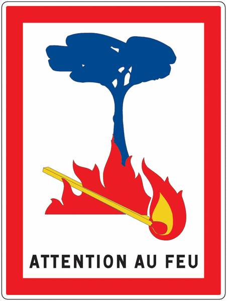
Preventing fires and staying safe in the event of a fire
If you see a fire breaking out, alert the fire brigade immediately by dialling one of the following numbers: 112, 18 or 114 for people with hearing impairments.
By following these simple, responsible steps, everyone can help prevent forest fires and protect our shared natural heritage.
To find out more, you can visit the Ministry of Ecology’s dedicated webpage:
- Forest fires and vegetation: let’s make sure we know what to do
Access to forest weather information
To find out today’s weather forecast and fire risk by department, visit Météo France:

Maps and fires
A number of maps to round off this topic and keep you informed: obligations regarding brush clearing, DFCI* contact details, and current fires in France and around the world.
DFCI contact details
As a mapping tool for forest fire prevention, the DFCI grid system makes it easier to pinpoint the location of a fire using precise coordinates that are useful to the emergency services:
Legal obligations regarding brush clearing
The online map showing the Information Zoning for Legal Brush-Clearing Obligations (OLD) provides information on the measures you need to take for your land (depth of brush-clearing from the dwelling, distance between trees, pruning height, etc.) in the following regions of France:
For further information on your obligations, please contact your local town hall or prefecture.
Forest fires and ongoing fires
Interactive maps showing current forest fires and wildfires in France, Europe and around the world.
Google Maps and fires
During the summer, Google Maps offers a special version of its map showing the major wildfires in France and around the world.

Based on the Firms website (see below), which provides satellite analysis of fires, the online tool adds an extra layer labelled ‘forest fires’, with some additional information appearing when you click on or zoom in on a particular fire.

You can access the map directly, complete with the overlay and details regarding forest fires in France:
Forest fires in France
Developed bythe Forest Fire Association, a national map shows the location of current fires (non-exhaustive list):
Fires around the world
FIRMS (Fire Information for Resource Management System) is a free platform developed by NASA that enables the detection and visualisation of fire hotspots across the globe in near real time, using satellite data (MODIS and VIIRS).
Accessible via an interactive map, FIRMS provides detailed information (location, time, data source) that is useful for natural resource management, forest fire control and the monitoring of conflict-related fires. Originally developed by the University of Maryland, the tool integrates easily with other GIS applications and is now an essential resource for researchers, authorities and the general public.
Extract from the FIRMS interactive map:
- Another map of wildfires around the world and in France: Geamap ↗
Travel+
- Estimate of wildfires in Europe, EFFIS ↗
- Database on Forest Fires in France, BDIFF ↗
- Forest fires: six questions about firefighting, Public Life ↗
- Forest Fire Protection (DFCI), Wikipedia ↗ / Valabre ↗
- Interactive map showing rising sea levels
- Map of global warming by region