From canoe to barge to sailboat, the map of river tourism on the Rhône is a must for all river travellers. To make your journey easier, here is a selection of links and applications to help you organise your navigation on France’s most powerful waterway.

The Rhône River and river tourism
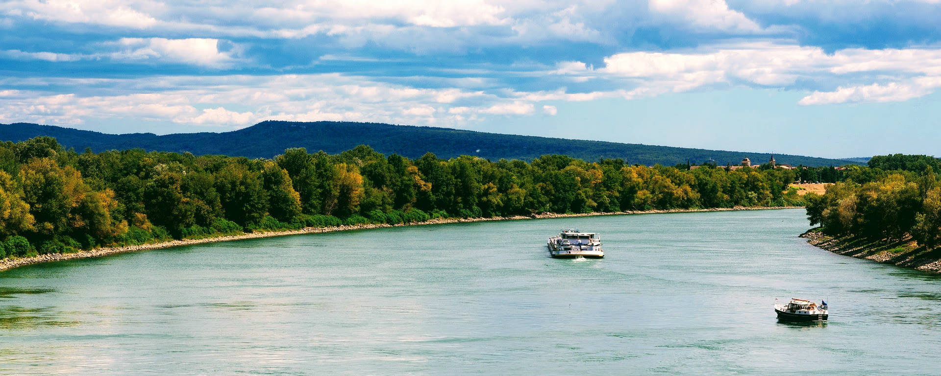
Long considered a central trade route, the Rhône is now increasingly important for river tourism in France, with a 50% increase in the number of pleasure boaters over the last 10 years 1. .
The power of the Rhône and the scale of its development make it a navigable river from the Mediterranean to the Saône, towards the Saine and the Rhine, a unique river junction between northern and southern Europe. Its stature, its infrastructure and the diversity of its landscapes also make it a major waterway for cruises in France, crossing affluent valleys, cities with an ancient heritage and remarkable natural areas.
In response to user demand, companies, local authorities and institutions are trying to facilitate access to information and the preparation of career paths.
The specific characteristics of navigation on the Rhône
Navigation on the Rhône differs markedly from that on Europe’s major navigable rivers, whether the Seine or the Rhine. One of the main characteristics is the strength of the current, the width of the riverbed and the density of river traffic, both commercial and tourist. The hydrological variations over the seasons, influenced by the Mediterranean and Alpine regimes, require greater technical expertise, both for experienced yachtsmen and cruisers.
There are also specific regulations. In addition to the boating licence, certain sections require compliance with dedicated signage, speed limits or allocated passage slots in locks, especially during the high season. The relevant authorities, Voies navigables de France (VNF), Compagnie nationale du Rhône (CNR) and local authorities, coordinate and monitor operations along the entire route.
Canals attached to the natural river, such as the Donzère-Mondragon canal or the Miribel canal, create bifurcations, reinforcing the connectivity of the Rhône with other river basins and making it possible to avoid certain natural or technical obstacles. Specific infrastructures, such as large locks and automated management systems, have been put in place to ensure the safety and smooth running of long-distance navigation.
Ports, river stops and tourist ports of call
Marinas are dotted along the Rhone, offering varying capacities depending on the size of the craft and the number of seasonal visitors. Some of them have been certified or awarded a label, and offer refuelling, technical support, information points and additional boat maintenance services. Others are simply mooring points for a temporary stopover.
River stops, which are often developed by local authorities, meet more specific needs: stopping-off points for walks, easier access to town centres, places to relax or for basic supplies. Some rest areas stand out for their proximity to listed sites, protected natural areas or cycle routes, encouraging intermodality and tourist discovery of the area.
Monumental locks all along the river ensure safe navigation and regulate access to sensitive areas. Nearby, a number of dams help to modulate the river’s flow and generate hydroelectric power, without completely blocking ecological continuity and river mobility.
Last but not least, themed tourist stop-offs, either on the maps or near the flagship towns, highlight points of interest in terms of heritage or the environment. Travellers can punctuate their itinerary with cultural visits, wine tastings or nature walks, adding to the appeal of the Rhone valley as a tourist destination. The uneven distribution of facilities, which depends on the morphology of the river and the potential for local appeal, suggests that the stages of the journey should be carefully planned.
River tourism on video
Published by the Compagnie National du Rhône (CNR 2), a one-minute video promoting river tourism on the Rhône:
Diversity of uses and audiences
Depending on the season and the area, the Rhône river welcomes a wide variety of visitors: year-round yachtsmen, river cruise enthusiasts, yacht clubs, occasional travellers or school groups in water classes. The type of activity varies according to the type of experience required: top-of-the-range cruises, independent navigation on small boats, urban connections or itinerant discovery of villages and landscapes.
The growth in themed cruises illustrates the diversification of the offer: some itineraries are aimed at heritage lovers, while others target nature enthusiasts or families looking for a gentle, accessible experience. Local tourism is often based around ports of call and rest areas, offering local residents the chance to rediscover their area.
By way of example, here are a few varied river activities along the water:
- Les péniches du Val de Rhône 3 offers water class holidays with a tailor-made educational project

- The Compagnie des Canotiers Rhône-Saône organises tours from Saint-Vallier to La Voulte with bicycle links to the valley’s greenways.

- CroisiEurope and its fleet of MS boats offer themed cruises between the Saône, the Rhône and the Camargue.

And to continue, here are the main sources of practical information and maps for the Rhône waterways.
Maps of the Rhône waterways
Before setting off on the water, whether in your dreams or in reality, you need to consult some information to help you imagine your journey: the gauges of the Rhône or Saône, adjacent river links, possible stops in ports, points of sale for navigation tickets and other tourist attractions (museums, works of art) to discover along the valley.
In view of the large number of infrastructures, the river maps offer a comprehensive and dynamic representation of the Rhône navigation network. Available online, they can be used to locate marinas, stopping places,lock locations, dams and other essential facilities in real time. Passengers can also find the canal segments that extend the river, the junction points between the Rhône, Saône or Mediterranean, and the ports of call with dedicated services: provisioning, sanitary facilities, restaurants or parking areas specifically for pleasure craft.
Users can plan their itinerary according to distance, draught and height under bridge, as well as anticipating the constraints and opportunities available on each section of the river. The display allows the route to be adapted according to the type of boat (barge, speedboat, zodiac or river shuttle) and the nature of the trip, whether it’s acruise lasting several days or a self-guided day trip.
With a range of maps available online, to download or to order, you can discover the navigable network of the Rhône with tourist information to help you discover the valley and practical links for your journey. Whether you’re a seasoned traveller or a novice, the river maps will be invaluable in helping you find your way around, anticipating operational constraints (timetables, bookings, available equipment) and adapting your itinerary to seasonal openings and closures.
VNF map of river tourism on the Rhône
The public body Voies Navigables de France (VNF) has produced a map of river tourism and France’s waterways. Here is an extract for the Rhône and Saône valleys.
This map is part of an initiative to develop the tourism potential of rivers and canals, with a national vision for pleasure boating. It takes the form of a map of the navigable waterways of France (VNF), including the Rhône, the Saône and the link to the south via the Canal du Rhône à Sète 4 to the Canal du Midi 5:

Legend for the map of France’s waterways :

Interactive map of navigation on the Rhône
Here’s an interactive map to help you navigate the Rhône River, showing the ports, river stops, locks, canals and main towns in the valley:
Source: River navigation charts for the Rhône
Map of anchorages in France
Also produced by VNF, the map of moorings 7 on the Rhône and connected waterways:


Navigation rectangle
The navigation rectangle is a rectangular geographical area that delimits the probable location of a vessel. It is calculated using the estimated position and adding the margins of error associated with the instruments and navigation conditions. Here is an explanatory diagram linked to the legend:

The Rhône river in a mobile application
Would you like to consult a guide during your trip? Here’s the ideal tool for relaxed river tourism on the Rhône.
Rhône and NAVI river guide
What about browsing from your connected phone?
Stay informed on the Rhône and on France’s navigable rivers and canals with the Voies Navigables de France application. The VNF river guide for the Rhône river section includes the Petit Rhône, the Barcarin canal, the Saint-Louis canal, the Rhône à Sète canal and the Etang de Thau (towards the Canal du Midi).
The Navi mobile application, distributed free of charge by Voies navigables de France (VNF), offers you a complete solution for navigating the Rhône from your boat. On the menu: real-time data (inland navigation, closures, locks, moorings, flows, clearances, flooding, etc.), geolocation for your river travels, offline operation and much more.
To find out more about Navi, consult the practical guide or download the application, visit the dedicated page :

Other maps of the Rhône valley
Looking for other maps and geographical features?
Towns and villages crossed by the river, Lake Geneva, dams along the valley…
Visit the page dedicated to maps of the Rhône valley, the river and its basin:
The Rhône River navigable on the web
Are you looking for a river itinerary between the Saône and the Rhône-Mediterranean, or for information on navigating the river?
Route planner, weather, hydrology, RNPC alerts (Restrictions on Navigation during Flood Periods) and online news with the VNF route planner and InfoRhône.
VNF river route planner
The VNF river route planner website is a tool for planning journeys on France’s inland waterway network:
- Calculate personaliseditineraries based on boat and date
- Consult information on structures, navigation stoppages and restrictions
- Search for notices to skippers
The Voies navigables de France (VNF) river route planner lets you generate a map of your route: distance from port to port, locks, navigation times and other practical information.

To make your own, go to the VNF website and select your point of departure and arrival as well as the options required to launch the calculation and make a personalised map of your journey on the Rhône river.

- Direct access to the VNF river route planner:
InfoRhône for navigation
Another online river information site, InfoRhône. Managed by the CNR (Compagnie Nationale du Rhône), it provides navigational assistance on the Rhône. It provides navigators with essential information for their journey, including :
- Navigation information
Flows, water levels, air draughts and berths. - Notices to Shipping and Weather
Shipping restrictions during periods of flooding (RNPC) and weather forecasts. - Cartography
Interactive map to track the position of pleasure craft locks and boats equipped with AIS (Automatic Identification System 8 ) - Real-time data
The site provides data from automatic recordings, with a possible time lag between updates.

- Direct access to the InfoRhône interactive map :
Other maps of the Rhône river
The river, Lake Geneva, the Camargue, river tourism in the valley and other maps of the Rhône :
Waterways in France
And to continue your journey along France’s canals, rivers and waterways, visit the French waterways page:
Travel+
- Key figures for river tourism, CNR ↩︎
- The Compagnie Nationale du Rhône ↩︎
- Water class educational project, Péniches du Val de Rhône ↩︎
- Canal du Rhône à Sète ↩︎
- Canal du Midi and World Heritage ↩︎
- Sailing as a yachtsman in France, VNF ↩︎
- What is anchoring? Wikipedia ↩︎
- Automatic Identification System (AIS), Wikipedia ↩︎
- Destination: Rhône Valley
- Rhône and Mediterranean flood warning system
- Map of river tourism on the Rhône
- Territories, towns, and villages crossed by the Rhône
- Map of the Rhône River and its tributaries
- By bike: ViaRhôna and Route du Rhône
- Where to stay along the Rhône River?
- IGN maps: Rhône Valley