
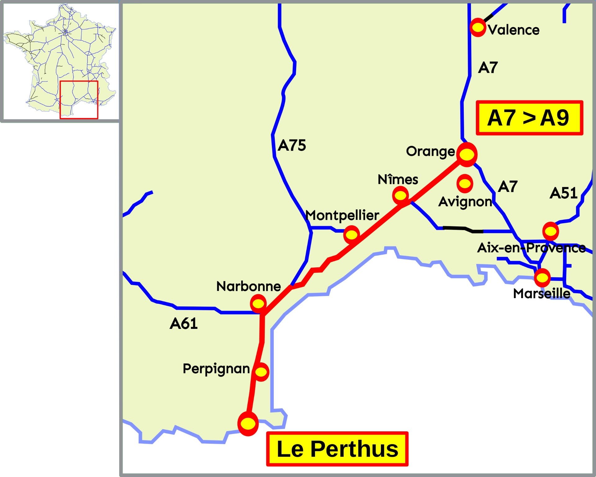
From Orange, theA9 motorway, known as the Languedoc and Catalan motorways, runs 280 kilometres along the Mediterranean to the Spanish border, following the old via Dominitia.

Map of the A9 motorway route
Continuing theA7 motorway from Lyon and branching off towards the south-west and the Pyrenees at Orange, the A9 is managed by Autoroutes du Sud de la France(ASF).
Nicknamed the “Languedocienne” and then the “Catalane”, it is 280 kilometres long, with a section doubled by theA709 motorway near Montpellier.
From Orange to Perthus and the Spanish border, here is the route of the A9 with the main towns along the way and junctions with other motorways, from north to south:
Interactive maps of the A9 motorway
Interchanges, exits, A9 tolls
Looking for an exit or junction on the A9?
Along the A9, here are the exits, toll plazas and interchanges with their roadside reference points (PR*):
A9 motorway areas
Looking for a parking space on the A9?
Along the A9, entrances and exits, service areas, with roadside landmarks(PR*) :
Reader, instructions for use (French)
Traffic and routes on the A9
With Google Maps, you can find the route of the A9 with precise additional information, such as traffic, a satellite map, journey times depending on your departure point and distances between toll plazas:
Hotel, rental nearby
Find accommodation along your route, hotels and rentals near the A9:

Calculate the price of your A9 motorway journey
Looking for the price of your journey on the A9 motorway?
Consult the current rates on this page:

Traffic, accident, traffic jam on the A9
Interactive map to monitor traffic, accidents and traffic jams on the A9 :

The network in France
Presentation, route, tariffs and information on motorways in France:
Electronic motorway toll tag offer
Private and professional subscription for Ulys electronic toll collection on all French motorways: