What does the future hold for the coasts of the French Overseas Territories? Find the answer in maps, with a simulation of the rise in overseas waters between the Atlantic, Indian and Pacific Oceans and the Caribbean Sea, depending on your scenario.

Rising water levels overseas?
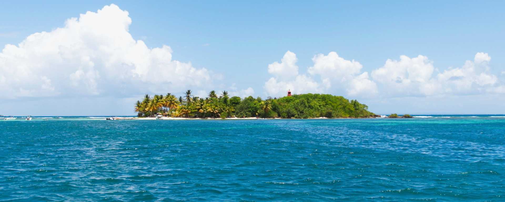
Between the retreat of the coastline and the natural mobility of the coastline, the assessment of sea levels is a complex science to grasp, with one unanimous observation: for the last 30 years, the waters have been rising throughout the world, particularly in the French Overseas Territories, which are mainly islands.
With 14,500 kilometres of coastline in the French Overseas Territories, this represents over 70% of the French coastline. These regions are therefore directly affected by rising sea levels.
Some figures on the French overseas coast :
- 90 communes are on the overseas coast (compared with 885 in mainland France)
- 25% of the coastline is currently affected by rising sea levels
- 300 kilometres of coastline are already retreating by between 25 centimetres and 2 metres a year
- 700,000 hectares and 1.4 million people are already at risk from extreme water levels
Estimates include the loss of 5% of Martinique by 2100, 2% of New Caledonia and a third of the islands in French Polynesia, totalling around 120 islets and atolls.
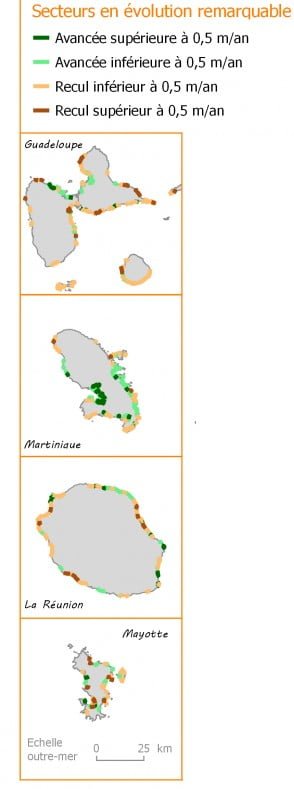
Coastal erosion
Accelerated by rising sea levels and climate change, coastal erosion is one of the ongoing natural phenomena affecting overseas coasts, with variations from one region to another.
Coastal erosion in France means 20% of the natural coastline retreating and around 30 km² of land disappearing over a period of 50 years, with both advances and retreats between the seas and oceans of France.
- Map of the national coastal erosion indicator for Overseas France:
Overseas simulation by territory
Here are just a few maps to help you simulate the rise in sea levels in the French overseas territories by coastal region: the Caribbean Sea, the Atlantic Ocean, the Pacific Ocean and the Indian Ocean.
For all the pages accessible below, the water level rise simulation map for each territory concerned is that of Climate Central. The default setting for the maps is a one-metre rise in sea level, which can be modified as required.
For more details on the origin of the maps, practical features and scientific sources, go to the dedicated page.
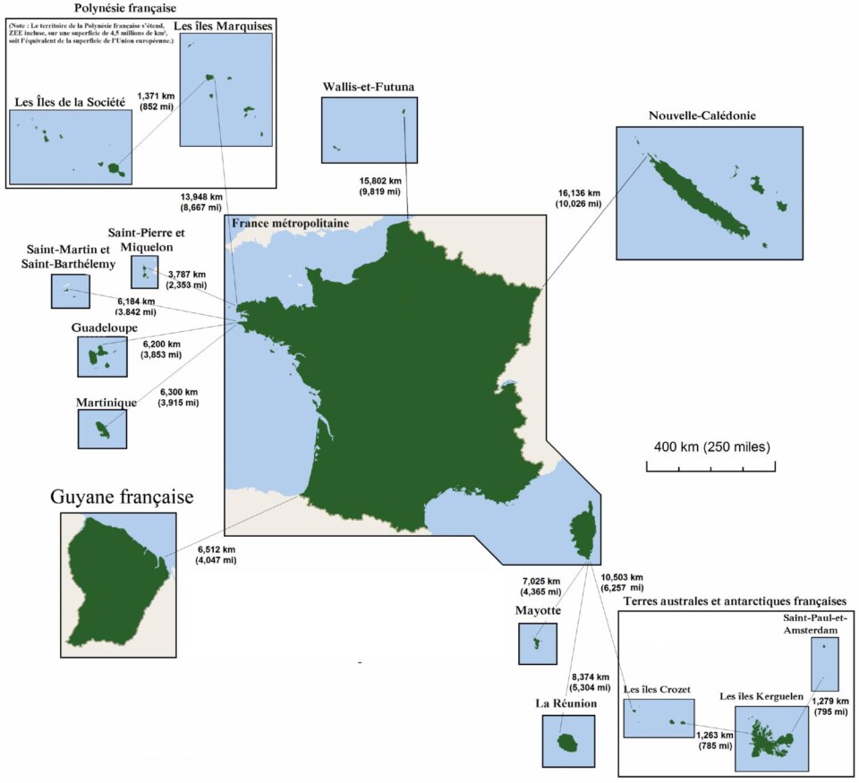
Map of overseas territories
Maps of rising water levels overseas
And to do your simulation, find the territory concerned in the list below:
- Caribbean islands and French Guiana
- New Caledonia
- French Polynesia
- Reunion Island
- Saint Pierre and Miquelon
Caribbean Sea and South Atlantic Ocean
Simulation of rising sea levels in the Caribbean Sea for Guadeloupe, Martinique, Saint-Martin and French Guiana:
Pacific Ocean
Simulation of rising sea levels in the Pacific Ocean for New Caledonia:
French Polynesia, including the Society Islands, Marquise and Wallis and Futuna
Indian Ocean
Simulation of rising sea levels in the Indian Ocean and Mozambique Channel with Reunion and Mayotte:
North Atlantic Ocean
Focus on the island of Saint-Pierre-et-Miquelon :
You can also consult the maps simulating rising sea levels for the French coast in mainland France or islands and coastlines around the world on the page below:

Travel+
- Interactive map of rising sea levels
- Map of global warming by region
- Forest weather and fire risk in France (French)
- Going back in time with photos and maps, IGN (French)
- Vigicrues, risks and flooding (French)
- Environment, pages and articles
- National coastal erosion indicator, CEREMA
- Overseas France, Wikipedia
- Key figures for the coastline, Ministry
- Canals and waterways in France and towards Europe
- Watersheds in France and Europe (French)
- Flooding in France (French)
- Along the Rhône river